In-Situ Upgrading Using High-resolution RS Images GIS Maps Existing Slum Layouts And Infrastructure
Description
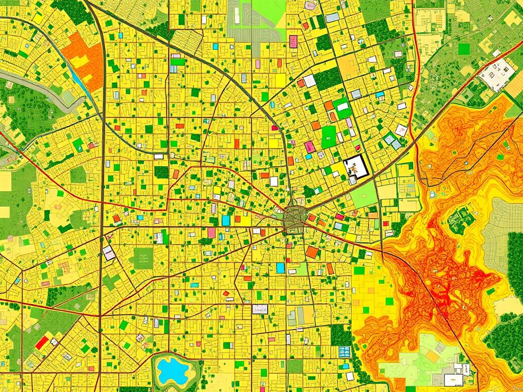
In-Situ Upgrading Using high-resolution RS images, GIS maps existing slum layouts and infrastructure. Spatial analysis identifies areas lacking basic services like roads, water, and sanitation, helping plan improvements without relocating residents. Land Use Planning GIS integrates satellite data to map current land use and simulate urban expansion. This helps identify suitable areas for affordable housing and prevents formation of new slums. Zoning and Policy GIS overlays hazard maps (flood, landslide) with settlement data from RS to detect risky zones. Planners use this information to set zoning rules and restrict construction in unsafe or environmentally sensitive areas.
Created On
17.10.2025 05:34
Related Images

A large gorilla, half submerged, protects a small wooden boa

The long room with a high ceiling had a skylight. There was

nice infantry asian looking knightess in armor surrender on

American Kenworth truck with trailer. Airbrush paintwork on

In a flat green wheat field, there is a crop circle

low roar, cinematic, ultrarealistic, high definition, 4K, p

Vector illustration of a 40-year-old curly-haired blonde wom

only a seductive woman head with a messy bun attached on a p

Create a photorealistic close-up image of a female and a mal

The giant hairy monster has only a single flaming eye, and o

3d vector Typography text effect sublimation of a lolipop

in the illustration of a studio with Gothic decor, a mannequ

overview of the butcher and his traditional white, large, lo

Royal title images for lost Atlantis